|
Smoothing
The
spatial interpolation of the incidence rates using the uniform
methodology invented and developed at the Finnish Cancer Registry
(Pukkala
et al, 2001).
This method has also been used for cancer map production
for several other regions, including Northern
Europe (North-European Cancer
Atlas), all Nordic countries (incidence,mortality), Stockholm and
Gotland region in Sweden, The Netherlands,
Belgium
and Manila-Rizal region in
Philippines. The illustration method also works with other type of
phenomenom such as swine flu (THL).
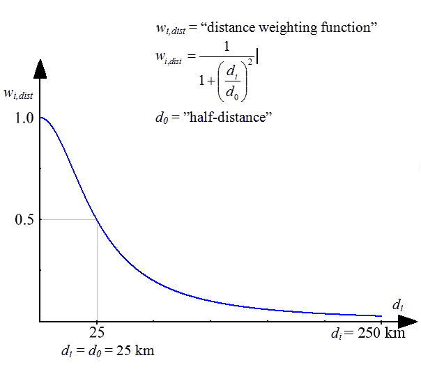
Rates
for 20 most populated cities in Finland are shown as circles
with a diameter relative to the population size. A colour
shading of the circles is indicating the incidence rate in that city. The remaining
rates are shown as floating averages of several neighbouring
municipalities. The rate for each grid (size 2 x 2 km) on the map
was defined as a weighted average of the age-adjusted incidence
rates in the municipalities, with population centres within 200 km
from the centre of the grid. The weights were inversely-associated
with distance; the weight being halved where the distance was 25
km (see weighting
function).
In addition, the weights were made directly proportional to the
sizes of the populations within the 200 km circle. The
northern parts of Finland are so sparsely populated (less than 1
inhabitant per km2)
that even the interpolated rates are prone to a high degree of
random variation. A white lining was superimposed on the colours
of these areas to reduce emphasis on the underlying rates.
|